 orecast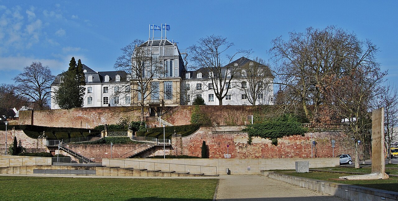
Saarbrücken is built on coal. Beneath the city lie the Saarbrücken layers, hard coal seams from the Carboniferous, formed around 300 million years ago from the swamp forests of a tropical lowland. The Saar coalfield was one of Germany's major mining districts for over two centuries, and it does not stop at the border: to the west the seams continue into the Lorraine coal basin, which is why many documented points nearby are French pits such as Wendel or Vouters.
Mining shaped the land and then ended in 2012. The last colliery at Ensdorf closed, partly because extraction was triggering measurable earth tremors. What remains is spoil heaps, ground subsidence and a heritage you can walk into. The Reden discovery site presents the geology and mining history, and the Völklingen Ironworks, a UNESCO World Heritage Site, shows what the coal was for. In the spoil and old outcrops you can find plant fossils from the coal age, scale trees, horsetails and fern fronds pressed cleanly into dark shale.
Besides coal, the record nearby lists lead, copper and a little salt, plus fossils from the region's Muschelkalk and Bunter sandstone. The Saarland was never an ore district, its substance lies in the seams and their plant impressions. ORECAST maps the documented sites and mine points within reach, on both sides of the border.
One point here is more serious than elsewhere. During the Second World War the Saarland lay along the Siegfried Line and was fought over, so many sites nearby are flagged as former war zones with possible unexploded ordnance. Where ORECAST shows that warning, do not dig, it is a danger to life. Add to that permit requirements and unstable ground above old mine workings.
Minerals & raw materials near Saarbrücken
Within 30 km of Saarbrücken our database holds 69 documented mineral and ore points. The most common commodities nearby:
Documented finds nearby
- BGR BSK1000: SteinkohleSteinkohle · source: BGR BSK10000.1 km
- BGR BSK1000: Kies und SandKies und Sand · source: BGR BSK10001.4 km
- BGR BSK1000: Kies und SandKies und Sand · source: BGR BSK10003 km
- Sandgrube KirschheckKies und Sand · source: LUA Saarland - Abbauflächen4.9 km
- BGR BSK1000: Kalkstein und DolomitsteinKalkstein und Dolomitstein · source: BGR BSK10007.2 km
- Simon WendelKohle · source: BRGM - Gisements France7.5 km
- Sandgrube HeidstockKies und Sand · source: LUA Saarland - Abbauflächen8 km
- Sandgrube SchmeerKies und Sand · source: LUA Saarland - Abbauflächen8.1 km
- Kalkbergwerk AuersmacherKalkstein und Dolomitstein · source: LUA Saarland - Abbauflächen9.3 km
- Lorraine (bassin houiller)Kohle · source: BRGM - Gisements France9.5 km
- WendelKohle · source: BRGM - Gisements France10.5 km
- Sandgrube VelsenKies und Sand · source: LUA Saarland - Abbauflächen11.7 km
- Sandgrube Elversberg IIKies und Sand · source: LUA Saarland - Abbauflächen12.1 km
- Sandgrube Elversberg IKies und Sand · source: LUA Saarland - Abbauflächen12.4 km
What the ground is made of
Official soil maps cover 51 % of the area within the radius. Each list names its source and refers to the part of that area the source describes. Where layers overlap, shares can add up to more than 100 %.
Soil types
Source: LUA Saarland BÜK100. Covers 92 % of the mapped area.
Material
Source: LGB Rheinland-Pfalz BFD50, LUA Saarland BÜK100. Covers 92 % of the mapped area.
Fossils near Saarbrücken
- SaarbrückenAegean · Grès à Voltzia · source: PBDB0.2 km
- SaarbrückenWestphalian C · Lower Saarbrucker layer · source: PBDB0.5 km
- Saarbrücken areaMiddle Triassic · Muschelkalk · source: PBDB0.5 km
- Railroad cutting at JägersfreudeWestphalian C · Saarbrucken’schen Kohlengebirges · source: PBDB2.5 km
- Jaegersfreude mineWestphalian C · Upper Saarbrucker layer · source: PBDB2.5 km
- Jägersfreude, vein dWestphalian D · Geisheck · source: PBDB2.8 km
- Herrensohr near Jägersfreude-SaarWestphalian C · Flammkohlenpartie · source: PBDB3.3 km
- SchafbruckeEarly Triassic · source: PBDB4.5 km
- Dudweiler (Bergschule Saarbrucken coll)Westphalian C · Lower Saarbrucker layer · source: PBDB4.7 km
- GersweilerWestphalian D · Auerswald coal seam · source: PBDB5 km
History & archaeology near Saarbrücken
- Battle of Saarbrückenbattlefield0.8 km
- Saarbrücker Schlosscastle_monument1.1 km
- Historischer Rodenhofcastle_monument1.4 km
- ehemaliges Torhauscastle_monument1.7 km
- Römerkastellarchaeological2.7 km
- Schloss Halbergcastle_monument3.1 km
- Ehemaliger Storchenweiherarchaeological3.4 km
- Keltenburgarchaeological3.8 km
- Fischbachbadarchaeological4 km
- Bataille de Forbach-Spicherenbattlefield4.5 km
Treasure hunting, law & safety
We'd rather underclaim than oversell: a promising geology is no guarantee, and you won't find invented numbers here. Digging and collecting are regulated across Europe and usually need a permit, and protected monuments and nature reserves are off-limits.
Frequently asked questions
Can I dig or collect finds near Saarbrücken?
Digging and collecting finds are regulated in most of Europe and usually need a permit; protected monuments and nature reserves are off-limits. ORECAST shows where protected/historical sites lie so you can check the local rules first. It is information, not a permit.
Where can I find gold near Saarbrücken?
Around Saarbrücken, gold is at most plausible as river placer (hobby-scale panning), not a documented deposit unless flagged on the map. ORECAST clearly separates documented finds from merely plausible geology, and it never promises gold.
What minerals and raw materials occur near Saarbrücken?
Within 30 km we list 69 documented mineral/ore points. The most common nearby are: Kies und Sand, Blei, Kohle, Kupfer, Steinkohle.
Are there fossils near Saarbrücken?
Yes, 88 scientific fossil localities are recorded within 30 km (with geological age and formation).
Is digging dangerous near Saarbrücken?
Possibly: former war zones can hold unexploded ordnance. Where a site is flagged with the ☢️ warning, never dig, it is a danger to life; contact the bomb-disposal service if in doubt.
Identify & compare:
Identify fossils · Identify rocks & minerals · Find gold · Find silver · Find gemstones · App comparison
Explore other regions:
Idar-Oberstein · Trier · Bonn · Freiburg (Black Forest) · Cologne · Aachen