 orecast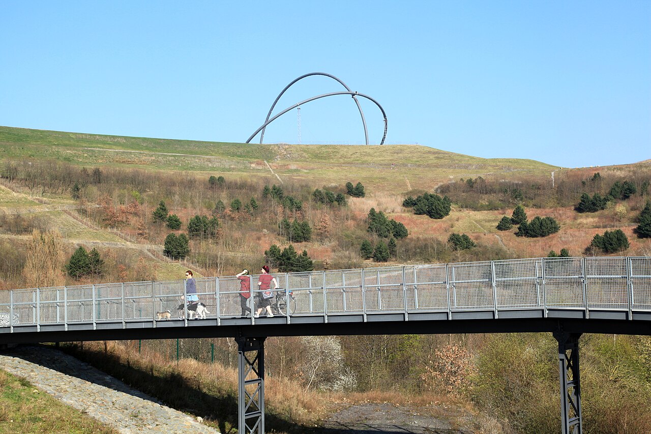
The Ruhr was Germany's largest hard-coal district, and no part of the country is as riddled with workings as this one. Beneath the cities between Duisburg and Dortmund lie the Carboniferous seams, formed some 300 million years ago from tropical swamp forests, and between them run the roadways, shafts and voids of two centuries of industrial mining. The last colliery, Prosper-Haniel in Bottrop, closed at the end of 2018, but what was built underground did not disappear with it.
The heritage is visible everywhere. The Zollverein colliery in Essen, once the largest hard-coal mine in the world, is now a UNESCO World Heritage Site; spoil tips such as Haniel and Hoheward have become lookout hills. And below the surface, work continues: to keep rising mine water away from the drinking-water layers it is pumped permanently at several sites, a perpetual obligation that will never end. How serious forgotten voids can become was shown by the ground collapse at Bochum-Wattenscheid in January 2000, when three garages and the cars inside vanished into a crater forty metres deep.
For collectors, the Ruhr is above all a fossil landscape. On the spoil tips and in old exposures you can find plant fossils from the coal age: scale trees, seal trees, horsetails and fern fronds pressed into dark shale. The Ruhr was never an ore district. Its wealth lay in coal, and companions such as pyrite or clay ironstone are by-catch rather than a target. ORECAST maps the documented mining and find points within reach, with hazard flags where our data carries them.
Safety comes first here. Old shafts and adits are not secured, many merely covered over and invisible on the ground. They are no destination for a day out. The Ruhr was also one of the most heavily bombed areas of Europe in the Second World War, and unexploded ordnance is still routine work for the disposal services. Where ORECAST shows a warning, you do not dig. Collecting on spoil tips needs the owner's permission, and permit requirements apply as everywhere in Germany.
Minerals & raw materials in the Ruhr area
Within 45 km of the Ruhr area our database holds 3347 documented mineral and ore points. The most common commodities nearby:
Documented finds nearby
- BGR BSK1000: SteinkohleSteinkohle · source: BGR BSK10000 km
- GD NRW RK50 LG: Ton/SchluffTon/Schluff · source: GD NRW RK50 LG0 km
- Ruhrsandstein - Sandstein, meist fein- bis mittelkörnig, auch grobkörnig. Feldspat führend bis feldspatreich, oft mit kohligen Flittern. Die Bindung ist überwiegend kieselig oder tonig-kieselig, untergeordnet tonig oder karbonatisch. Stellenweise Korn-an-Korn-Bindung. (Eignung: Werkstein)Sandstein · source: GD NRW RK50 FG1.8 km
- GD NRW RK50 LG: Ton/SchluffTon/Schluff · source: GD NRW RK50 LG4.5 km
- GD NRW RK50 LG: Ton/SchluffTon/Schluff · source: GD NRW RK50 LG4.6 km
- GD NRW RK50 LG: Ton/SchluffTon/Schluff · source: GD NRW RK50 LG4.9 km
- Ruhrsandstein - Sandstein, meist fein- bis mittelkörnig, auch grobkörnig. Feldspat führend bis feldspatreich, oft mit kohligen Flittern. Die Bindung ist überwiegend kieselig oder tonig-kieselig, untergeordnet tonig oder karbonatisch. Stellenweise Korn-an-Korn-Bindung. (Eignung: Werkstein)Sandstein · source: GD NRW RK50 FG5.5 km
- Ruhrsandstein - Sandstein, meist fein- bis mittelkörnig, auch grobkörnig. Feldspat führend bis feldspatreich, oft mit kohligen Flittern. Die Bindung ist überwiegend kieselig oder tonig-kieselig, untergeordnet tonig oder karbonatisch. Stellenweise Korn-an-Korn-Bindung. (Eignung: Werkstein)Sandstein · source: GD NRW RK50 FG5.6 km
- Ruhrsandstein - Sandstein, meist fein- bis mittelkörnig, auch grobkörnig. Feldspat führend bis feldspatreich, oft mit kohligen Flittern. Die Bindung ist überwiegend kieselig oder tonig-kieselig, untergeordnet tonig oder karbonatisch. Stellenweise Korn-an-Korn-Bindung. (Eignung: Werkstein)Sandstein · source: GD NRW RK50 FG5.6 km
- Ruhrsandstein - Sandstein, meist fein- bis mittelkörnig, auch grobkörnig. Feldspat führend bis feldspatreich, oft mit kohligen Flittern. Die Bindung ist überwiegend kieselig oder tonig-kieselig, untergeordnet tonig oder karbonatisch. Stellenweise Korn-an-Korn-Bindung. (Eignung: Werkstein)Sandstein · source: GD NRW RK50 FG5.6 km
- BGR BSK1000: Kies und SandKies und Sand · source: BGR BSK10005.6 km
- Ruhrsandstein - Sandstein, meist fein- bis mittelkörnig, auch grobkörnig. Feldspat führend bis feldspatreich, oft mit kohligen Flittern. Die Bindung ist überwiegend kieselig oder tonig-kieselig, untergeordnet tonig oder karbonatisch. Stellenweise Korn-an-Korn-Bindung. (Eignung: Werkstein)Sandstein · source: GD NRW RK50 FG5.7 km
- Ruhrsandstein - Sandstein, meist fein- bis mittelkörnig, auch grobkörnig. Feldspat führend bis feldspatreich, oft mit kohligen Flittern. Die Bindung ist überwiegend kieselig oder tonig-kieselig, untergeordnet tonig oder karbonatisch. Stellenweise Korn-an-Korn-Bindung. (Eignung: Werkstein)Sandstein · source: GD NRW RK50 FG5.7 km
- Ruhrsandstein - Sandstein, meist fein- bis mittelkörnig, auch grobkörnig. Feldspat führend bis feldspatreich, oft mit kohligen Flittern. Die Bindung ist überwiegend kieselig oder tonig-kieselig, untergeordnet tonig oder karbonatisch. Stellenweise Korn-an-Korn-Bindung. (Eignung: Werkstein)Sandstein · source: GD NRW RK50 FG5.7 km
What the ground is made of
Official soil maps cover 53 % of the area within the radius. Each list names its source and refers to the part of that area the source describes. Where layers overlap, shares can add up to more than 100 %.
Material
Source: GD NRW RK50 LG.
Fossils in the Ruhr area
- BochumSenonian · source: PBDB2 km
- Bochum area (Universität Bonn collection)Early Turonian · source: PBDB2.6 km
- Friedrich der Große colliery, shaft 3/4, Hermann 2 seamWestphalian A · Bochum · source: PBDB9.3 km
- Westphalian Pläner (Ziegler collection)Late Turonian · source: PBDB9.3 km
- Essen (Mittelcenoman)Middle Cenomanian · Essener Grünsand · source: PBDB11.8 km
- Essen-on-the-Ruhr (BMNH collection)Hauterivian · source: PBDB12 km
- Schmiedestraße quarry, HaßlinghausenMarsdenian · Upper Hagen Beds · source: PBDB13 km
- Dortmund-Bochum railway guard house (Dorstfeld quarry)Late Turonian · source: PBDB14.2 km
- Hauptfloez seam, St. Hubertus mineNamurian · Sprockhoeveler · source: PBDB14.4 km
- Essen GreensandCenomanian · source: PBDB14.5 km
History & archaeology in the Ruhr area
- Haus Laercastle_monument4.1 km
- Sylvesterkapellearchaeological4.2 km
- Haus Dahlhausencastle_monument4.2 km
- Adelssitz Weitmarcastle_monument4.2 km
- Haus Weitmararchaeological4.2 km
- Alte Verladeanlage der Zeche Lothringenarchaeological7 km
- Haus Langendreercastle_monument7.4 km
- Haus Langendreercastle_monument7.4 km
- Haus Herbedecastle_monument7.5 km
- ehm. Maschinenhaus Zeche Mont Cenis Schacht 5archaeological7.8 km
Treasure hunting, law & safety
We'd rather underclaim than oversell: a promising geology is no guarantee, and you won't find invented numbers here. Digging and collecting are regulated across Europe and usually need a permit, and protected monuments and nature reserves are off-limits.
Frequently asked questions
Can I dig or collect finds in the Ruhr area?
Digging and collecting finds are regulated in most of Europe and usually need a permit; protected monuments and nature reserves are off-limits. ORECAST shows where protected/historical sites lie so you can check the local rules first. It is information, not a permit.
Where can I find gold in the Ruhr area?
Around the Ruhr area, gold is at most plausible as river placer (hobby-scale panning), not a documented deposit unless flagged on the map. ORECAST clearly separates documented finds from merely plausible geology, and it never promises gold.
What minerals and raw materials occur in the Ruhr area?
Within 45 km we list 3347 documented mineral/ore points. The most common nearby are: Sandstein, Tonstein, Karbonatgestein, Ton/Schluff, Kies/Kiessand.
Are there fossils in the Ruhr area?
Yes, 279 scientific fossil localities are recorded within 45 km (with geological age and formation).
Is digging dangerous in the Ruhr area?
Possibly: former war zones can hold unexploded ordnance. Where a site is flagged with the ☢️ warning, never dig, it is a danger to life; contact the bomb-disposal service if in doubt.
Identify & compare:
Identify fossils · Identify rocks & minerals · Find gold · Find silver · Find gemstones · App comparison
Explore other regions:
Essen (Ruhr) · Cologne · Bonn · Siegen (Siegerland) · Aachen · Maastricht