 orecast
 Play video
Clicking loads the video from YouTube. Nothing is loaded from YouTube or Google before that.
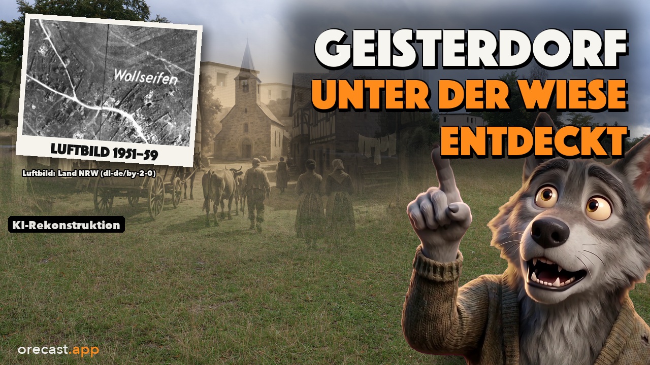
On an aerial photograph from 1951, every house in Wollseifen in the Eifel is still standing. You can make out barns, gardens and the road leading up to the church. Five years earlier, around 550 people lived here in roughly 120 families. Today only the church remains on the Dreiborn plateau, and the outlines of the farmsteads lie beneath the grass. Wollseifen is one of five places our new episode visits. Of each of them, little more is left than traces in the ground and a name on an old map.
Archaeologists call such an abandoned settlement a deserted village, in German a Wüstung. They exist in almost every region, often deep in the woods where nobody today would expect a village. To find one you do not need a spade. You need four ways of looking at the same spot.
Four layers on top of each other
The first layer is today's aerial image. At places like these it usually shows nothing but forest or pasture. The second layer is historical aerial photography. In North Rhine-Westphalia it goes back to the early 1950s, and a slider lets you blend between then and now. The third layer is old maps: the Prussian survey from around 1850, for Brandenburg the Schmettau map series drawn between 1767 and 1787, and for France the Cassini map from the 18th century. The fourth layer is the relief. A laser on board an aircraft measures the ground beneath the trees, the state survey offices turn this into a digital terrain model, and in low, raking light, ramparts, pits and sunken lanes begin to cast shadows.
Not every layer exists everywhere. Saxony has no aerial photographs from the 1950s, and for France our map has no current aerial image. Where a layer is missing, the map says so instead of papering over the gap.
Altenberg near Müsen: coins from a legend
Near Hilchenbach-Müsen in the Siegerland, a hilltop holds a mining settlement founded by 1212 at the latest and abandoned after 1280. For about a hundred years the miners dug ore containing lead, copper, zinc and silver out of the hill. In the relief the site stands out clearly. There are at least 33 medieval shafts whose collapsed mouths now lie as funnels in the ground, known in German as Pingen. Add to that sunken lanes and the foundations of houses. On the Prussian survey map, the name is written right into the forest: Altenberg.
Locals told a legend of a rich silver town whose godless miners were punished with fire and brimstone. In 1963 two men from Müsen, Hubert Cadel and Erwin Krämer, took the old stories seriously and started digging. In February 1964 they reported eleven silver coins. In the end no fewer than seventy coins were taken from the ground without permission. Only 43 of them are in museums today. Why the settlement came to an end remains open. The excavators consider a catastrophic fire possible, and the hidden coins point to troubled times. None of this has been proven.
Today an educational trail leads across the site, with a lookout tower and a car park. The Altenberg is a protected archaeological monument, and the shaft pits and spoil heaps are easy to see from the path. See the Altenberg on the map.
Dangelsdorf: a church without a village
In the Hoher Fläming hills near Görzke, the ruin of a fieldstone church from the first half of the 14th century stands in a pine forest. Its west wall with the gable tower still rises more than four metres. There is no longer a village to go with it. In 1375 the land register of Emperor Charles IV lists a place called "Dankelstorff" with 24 hides of land that no longer paid any dues. By 1465 the records speak of "the half deserted village". By then at the latest Dangelsdorf was empty, and probably earlier.
The relief is of little help here. The ground is flat and shows only a few sunken lanes. The strongest evidence comes from the third layer. On the Schmettau map, the words "alte Kirche" (old church) and "die wüste Feldmark Dangelsdorff" (the deserted fields of Dangelsdorf) are written at exactly this spot. The surveyor recorded the deserted village back in the 18th century. No source tells us why the people left. Specialists regard the tale of Hussite raiders or robber knights as a legend, because the dates do not fit. Plague, floods and bad years are thought more likely. The ruin is open to everyone and lies on circular trail 62 of the Hoher Fläming nature park.
Bleiberg on the Treppenhauer: a town beneath the forest
Near Sachsenburg and Frankenberg in Saxony there is a wooded ridge called the Treppenhauer. In the relief it turns into a field of craters. More than 180 shaft pits cover around twelve hectares, some of them up to eight metres deep, and almost the whole area is enclosed by a rampart and ditch. In the 13th and 14th centuries this was a mining town called Bleiberg. The miners extracted lead and copper ores rich in silver, and the silver was separated right on site.
Written records mention the town only twice, in 1318 and 1390. In the second half of the 14th century the inhabitants moved away, probably to Mittweida and Frankenberg, and the forest grew back over the pits. In 1755 a chronicler wrote that the site was too small for a town. Local lore turned out to be right anyway. Two hundred years later the heritage warden Joachim Seyffarth found pottery shards by the ditch, and the excavations that followed confirmed the town. In one of the pit houses a pot stood in a hole in the rock, sealed with clay. The excavators read it as food for the household spirits. Nobody knows exactly how many people lived in Bleiberg. The excavator estimates 800 to 1,000.
Wollseifen: three weeks to leave
Wollseifen is first mentioned in the 12th century. In mid-August 1946 the British military administration ordered the village to be cleared. The families were given three weeks, and from 1 September 1946 Wollseifen was a restricted zone and part of a military training area around Vogelsang castle. From 1950 the Belgian army trained there, and mock houses for urban combat were built among the old walls.
Franz-Josef Sistig was seventeen at the time. His family lived opposite the church. He told the German broadcaster WDR that the order was announced after high mass. His sisters still cleaned the house before they left. His father left the key in the door because he believed they would come back. They moved the furniture at night with a horse. "Vogelsang castle was our downfall," he said. On 1 January 2006 the area was opened to the public, and that day Sistig raised a glass of sparkling wine in the village with other former residents.
On the map, all four layers tell this story. The topographic map of 1940 shows every house. The aerial photo from the 1950s shows the houses still standing, later images only a grid of crumbling walls. In the relief, the outlines of the farmsteads are still pressed into the grass like a stamp. What remains standing is the church of St. Rochus, the school, a small transformer house and a wayside chapel, and a tactile model shows the village as it was in 1944. See Wollseifen on the map.
Fleury-devant-Douaumont: a village without inhabitants
The last place lies near Verdun in France. At the 1911 census, Fleury-devant-Douaumont had 422 inhabitants. Today it has none. In 1916, during the Battle of Verdun, the village was taken and retaken sixteen times within two months, according to the French Ministry of the Armed Forces. Afterwards nothing was left. After the war the state bought up land that could no longer be used, the so-called zone rouge, and let forest grow there. The legal basis was a law passed in April 1919.
Fleury nonetheless remained a commune. It has a mayor, appointed by the prefect, and a register office. The Cassini map shows the name, a map from the mid-19th century draws the village outline in red, and a map from around 1950 notes "Village détruit", destroyed village. The relief from the French LiDAR data no longer shows any house outlines. It shows craters, trenches in between and, at the edge, the pentagon of a fort. Today a stone with the family's name stands on each former house plot, and a chapel stands where the church used to be.
Look, but do not dig
All five sites are protected archaeological monuments or lie in protected areas. Digging and metal detecting are forbidden there. Wollseifen adds a real danger. The Eifel National Park warns that, because of possible unexploded ordnance, it is life-threatening to leave the marked paths anywhere on the former Vogelsang training area. If you find anything that looks like ammunition, leave it where it is and call the police on 110.
All five places can be visited. At the Altenberg an educational trail with a lookout tower crosses the site. Circular trail 62 from Görzke leads to the church ruin of Dangelsdorf. A hiking path runs over the Treppenhauer, and in the village the open-air museum Bergstadt Bleiberg is open from April to October. Trails lead to Wollseifen from Vogelsang, Einruhr and Herhahn. In Fleury you will find the Mémorial de Verdun.
The scenes from the past shown in the video were created with AI and are labelled as reconstructions. The maps, aerial photos, reliefs and photographs are real. The orecast map has all four layers ready for these places, with the old maps and aerial photos available in Pro. Perhaps you will find a village near you that survives only as a name on an old map. Tell us under the video which village is missing where you live.
Illustrations generated with AI.
Frequently asked questions
What is a deserted settlement?
Archaeologists use the term for a settlement that was abandoned and fell into ruin: a village, a farmstead or a mining camp. Sometimes only a field name or an entry on an old map recalls the place, sometimes a church still stands. The reasons vary. Epidemics, failed harvests, exhausted ore veins and war all played a part, and in Wollseifen in 1946 it was an eviction order.
How do you find a vanished village on the map?
You stack four layers over the same spot. Today's aerial image shows what is on top, usually forest or pasture. Historical aerial photos show what was still standing seventy years ago. Old maps such as the Prussian survey of around 1850 or the Schmettau map of Brandenburg often still carry the name. The relief from the laser scan reveals pits, ramparts and house outlines beneath the trees. Not every layer exists everywhere, and the map tells you when one is missing.
Are you allowed to search or dig at these sites?
No. All five sites are protected archaeological monuments or lie in protected areas, and digging or metal detecting is forbidden there. At Wollseifen the Eifel National Park warns that unexploded ordnance makes it life-threatening to leave the marked paths. Anything that looks like ammunition stays where it is and is reported to the police on 110. Looking and taking photographs is fine everywhere.
Why does Fleury-devant-Douaumont have a mayor but no inhabitants?
The village near Verdun was completely destroyed in the battle of 1916 and never rebuilt. France kept it as a commune all the same, as a place of remembrance. Since nobody lives there, the prefect appoints the mayor. The commune keeps a register office, and stones bearing the families' names mark where the houses once stood.