 orecast
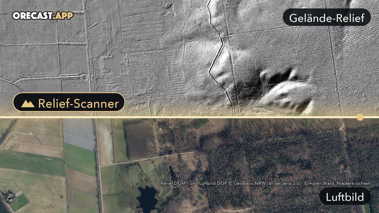
An aerial photo shows treetops. What lies in the ground beneath them stays hidden. The relief scanner changes that. It switches on the terrain relief in the orecast map, a shaded image of the ground without trees or buildings, calculated from official laser scan data. Traces appear that you often would not notice from the path: trenches and anti-tank ditches, rows of bunkers, the ramparts of old hillforts, spoil heaps and pits from mining, and sunken lanes that carts cut into the slope over centuries.
How it works
The "relief scanner" button sits at the top left of the map. One tap turns the map grey, lays the relief on top and zooms in close. Below the button you can choose whether the relief sits on grey or on the map, how strong the contrast is and how sharply the edges are drawn. Without a subscription the scanner shows a preview within one kilometre of the map centre, with orecast Pro the full relief.
Where it is sharpest
Across all of Germany we use the high-resolution terrain models of the state surveys, at a grid of one metre or finer. Even narrow trenches show up well there. Large parts of Europe, from Portugal to Finland, and the USA are covered as well; in Italy the relief is coarser. The exact data sources are listed under "Licences" at the bottom of the map.
Please do not dig
Many of the traces in the relief are protected archaeological monuments. Digging or detecting there without a permit is prohibited. Old wartime positions may also still contain ammunition. If you find something, leave it where it is and report it: ammunition to the police, everything else to the heritage authority. Looking, hiking and marvelling are very welcome.
The relief scanner works in the web map and in the iPhone and Android apps. A good first destination is the anti-tank ditch in the Elmpt forest.