 orecast
 Play video
Clicking loads the video from YouTube. Nothing is loaded from YouTube or Google before that.
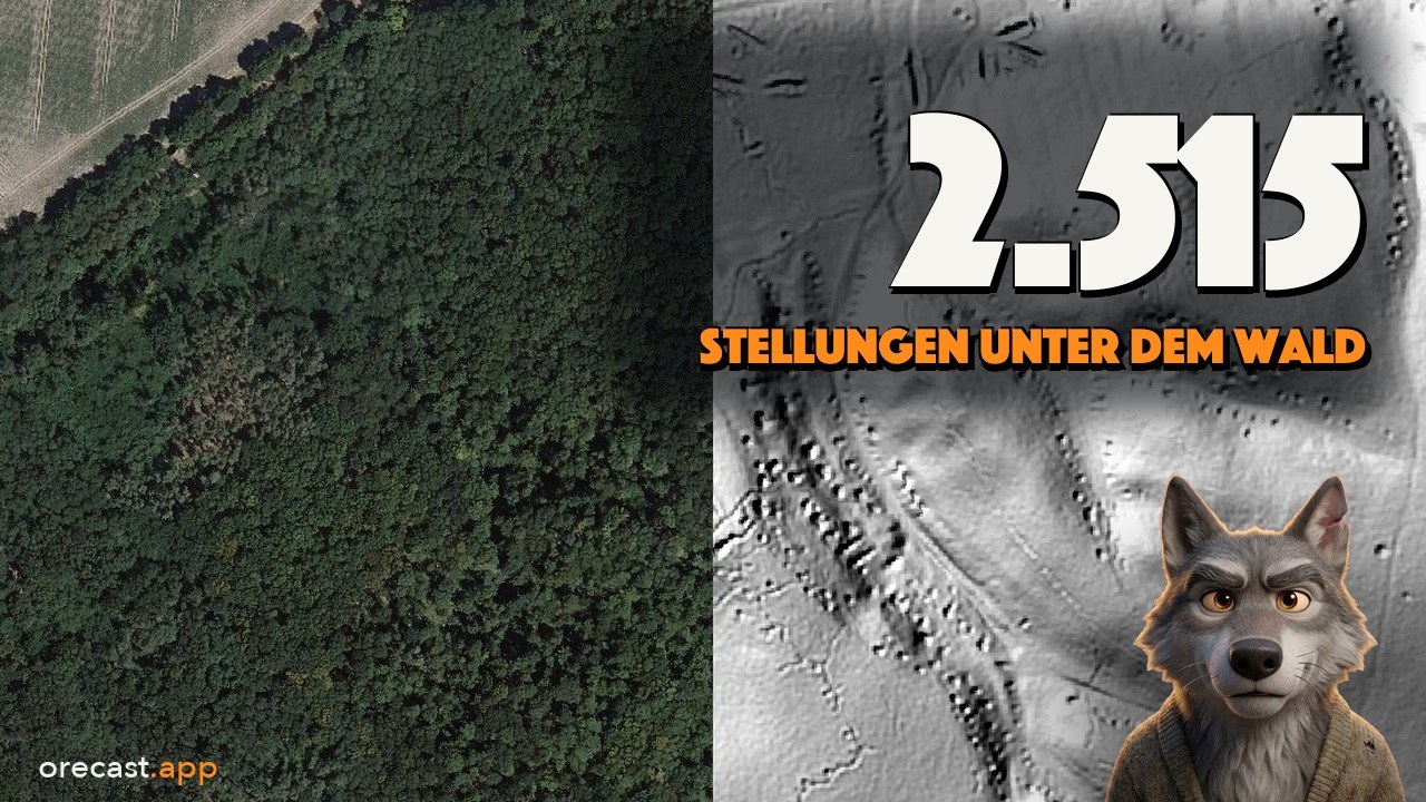
From above, a forest looks like a green carpet. An aerial photograph shows the treetops but never the ground beneath them, and that is where trenches, pits, ramparts and spoil heaps from earlier times lie hidden. On the Seelow Heights east of Berlin, researchers counted 2,515 wartime earthworks in the laser image, most of them in woodland. This is the work of a laser on an aircraft that, in effect, peels the forest away. In our new episode we explain how it works and visit six places in Germany and Denmark to see what is left.
How a laser peels away the forest
Under an aircraft hangs a laser that works like an echo in the mountains. It sends hundreds of thousands to millions of light pulses per second towards the ground and times how long each one takes to return. Light travels about thirty centimetres in a billionth of a second, so the travel time becomes a distance. Because the aircraft always knows where it is, each distance becomes a point on the earth, which in North Rhine-Westphalia is accurate in height to about twenty centimetres. Specialists call this LiDAR, we simply call it laser scanning.
The clever part happens in the canopy. A pulse of light comes back several times. As with rain on a tree, part of it stays at the top and only a little reaches the bottom. First the leaves answer, then a branch, and last of all usually the ground. Keep only those last echoes and the trees disappear. In North Rhine-Westphalia at least four points hit every square metre this way, in the Netherlands at least ten. From them the state survey offices calculate a terrain model with one height value for every metre of ground. On the computer it is lit at an angle from the north-west, and every small edge casts a shadow. A trench you would barely notice underfoot in the woods turns into a dark line. The laser cannot look into the ground, though. It only measures the surface.
Seelow Heights and the Reichswald: what 1945 left in the ground
On 16 April 1945 the Soviet attack on Berlin began at the Seelow Heights, a few kilometres from the river Oder. The battle lasted four days. Nobody knows exactly how many people died, and the estimates vary widely. A research team led by Martin Weber laid Brandenburg's laser terrain model over the battlefield and counted 2,515 earthworks across about 158 square kilometres, meaning trenches, pits, dugouts and covered positions for vehicles. Aerial photographs show only about three square kilometres of this. More than eighty percent of the traces lie on the wooded plateaus, while almost nothing has survived in the ploughed fields of the Oderbruch. Around 180 cemeteries, war graves and memorials are scattered across the battlefield, and the fallen are still being recovered today. Because the study also reports illegal treasure hunters, we never publish the coordinates of individual pits.
In the Reichswald forest near Kleve, on the Dutch border, British and Canadian troops attacked in February 1945. According to the archaeologists of the Rhineland regional authority, more than a thousand positions have been recorded there across 2,500 hectares, and thirteen of them are now protected monuments. The relief shows fields of small round pits, but the image alone cannot tell what each one was. That takes written records and excavation. At the edge of the forest lies the Reichswald Forest War Cemetery with more than 7,500 Commonwealth dead.
Kohnstein: a mountain the laser cannot see into
The Kohnstein near Nordhausen, on the southern edge of the Harz mountains, is made of gypsum and anhydrite. From 1936 an underground fuel depot was built inside it. On 28 August 1943 the SS brought the first 107 prisoners from Buchenwald to the mountain. They were forced to enlarge the tunnels into a factory where the V1 and V2 weapons were built from 1944. Around 60,000 people were held prisoner in the Mittelbau-Dora camp complex. At least 20,000 of them died, and the memorial itself considers this figure too low. On 11 April 1945 the US Army liberated the camp.
The relief shows the terraces of the quarry and, on the southern slope where the camp stood, rows of flat platforms in the forest. The tunnels stay hidden from the laser, so the video cuts the mountain open as a schematic 3D model. Two main tunnels, A and B, each run about 1.8 kilometres through the mountain, with 46 cross chambers between them like the rungs of a ladder. How much rock lies above them is not documented, so in the model it is a labelled estimate. For this place the video contains no re-enacted scenes, only the relief, the cross-section and archive photographs.
Rammelsberg: a thousand years of mining in the slope
At the Rammelsberg near Goslar ore was mined for more than a thousand years, copper, lead and zinc, plus silver and a little gold, around 27 million tonnes in total. Mining ended on 30 June 1988, and in 1992 the mine became a World Heritage Site together with the old town of Goslar. The laser image shows spoil heaps, the oldest from the 11th and 12th centuries, collapses above old workings and, on the western flank, fissures up to a hundred metres long. Beneath them lies the Old Deposit, an ore body around 600 metres long that reaches about 300 metres down. The mining archaeologists of the Lower Saxony heritage office map the underground workings onto an elevation model, much as we do in the video.
Trelleborg, Borgring and Hohenrode: lost and found again
Near Slagelse on the Danish island of Zealand lies Trelleborg, a Viking ring fortress whose timber was felled around 980. The rampart forms an almost perfect circle about 136 metres across on the inside. In the Danish elevation model, with its 0.4-metre grid, the ring, the gates and the outer ward stand out as if someone had drawn them with a compass.
The real laser story lies a good fifty kilometres further east near Køge, right next to the motorway. An aerial photograph from 1970 showed a faint circle in a field there. A trial excavation in 1971 and 1972 found nothing from the Viking Age, and the matter was considered closed. Then the national laser elevation model of 2009 revealed a round outline that matched the known ring fortresses exactly. A survey of the subsoil followed in 2013 and an excavation in 2014, which came upon the gates. It was Borgring, built after 966, the first newly discovered ring fortress in Denmark in more than six decades. Since 2023 Trelleborg and Borgring, together with three other fortresses, have been a World Heritage Site.
In the southern Harz near Grillenberg lies the deserted village of Hohenrode. A village stood here from the 10th to the 14th century, and between 1535 and 1547 the records call it abandoned. Why the people left is not known. In the relief a small group of shallow hollows can be seen. Germany has tens of thousands of deserted villages like this one.
Go and look, but do not dig
All the relief images from the episode can also be found in the relief scanner of the orecast map, in the browser and in the apps. Without a subscription the scanner shows a preview of one kilometre around the centre of the map, with orecast Pro the full relief. Good places to start are the Kohnstein, the Rammelsberg, Trelleborg, Borgring and Hohenrode.
Many of these places can be visited. The Seelow Heights memorial is open from Tuesday to Sunday, its outdoor grounds at any time. At the Mittelbau-Dora concentration camp memorial in Nordhausen the grounds and exhibitions are free, and part of tunnel A can be seen on a guided tour. At the Rammelsberg the visitor mine takes you underground, in Denmark the Trelleborg museum shows the ring and a reconstructed longhouse, and Hohenrode lies freely accessible in the forest, with wall remains and an information board. Please check opening times before you go.
Many traces in the relief are protected monuments, and nobody may dig or use a metal detector there without a permit. Ammunition still lies in the ground at Seelow and in the Reichswald. If you find something, leave it where it is and call the police, on 110 in Germany. Never enter old tunnels on your own. The time travel scenes in the video were generated with AI and are labelled as AI reconstructions, and the people in them are invented. The orecast map shows you what is documented at each of these places, and the video tells the whole story in just over sixteen minutes.
Illustrations generated with AI.
Frequently asked questions
How can a laser see through a forest?
It does not see through the trees, it uses the gaps between them. An aircraft sends hundreds of thousands to millions of light pulses per second towards the ground. Each pulse returns several times, first from the leaves, then from the branches and usually last from the ground. Keep only those last echoes and the forest disappears. From the ground points the state survey offices calculate a terrain model with a one-metre grid, and light falling at an angle from the north-west makes trenches and ramparts visible. The laser cannot look into the ground, it only measures the surface.
What did the laser scan show at the Seelow Heights?
A research team led by Martin Weber laid Brandenburg's laser terrain model over the battlefield of 1945 and counted 2,515 earthworks across about 158 square kilometres, meaning trenches, pits, dugouts and vehicle positions. Aerial photographs reveal only about three square kilometres of them. More than eighty percent of the traces lie on wooded plateaus. Parts of the area are protected monuments, ammunition still lies in the ground, and searching with a metal detector requires a permit in Brandenburg.
How was the Viking fortress of Borgring found?
An aerial photograph from 1970 showed a faint circle in a field near Køge on Zealand. A trial excavation in 1971 and 1972 found nothing from the Viking Age. Only Denmark's laser elevation model of 2009 revealed a circular outline that matched the known ring fortresses. A survey of the subsoil followed in 2013 and the first excavation in 2014. Borgring was built after 966 and since 2023 has been a World Heritage Site together with four other ring fortresses.
Can I look at the relief myself?
Yes. The relief scanner is part of the orecast map in the browser and in the apps for iPhone and Android. Without a subscription it shows a preview of one kilometre around the centre of the map, with orecast Pro the full relief for all sixteen German states and twenty further countries. Please only look, because many traces are protected monuments, and nobody digs there.