 orecast
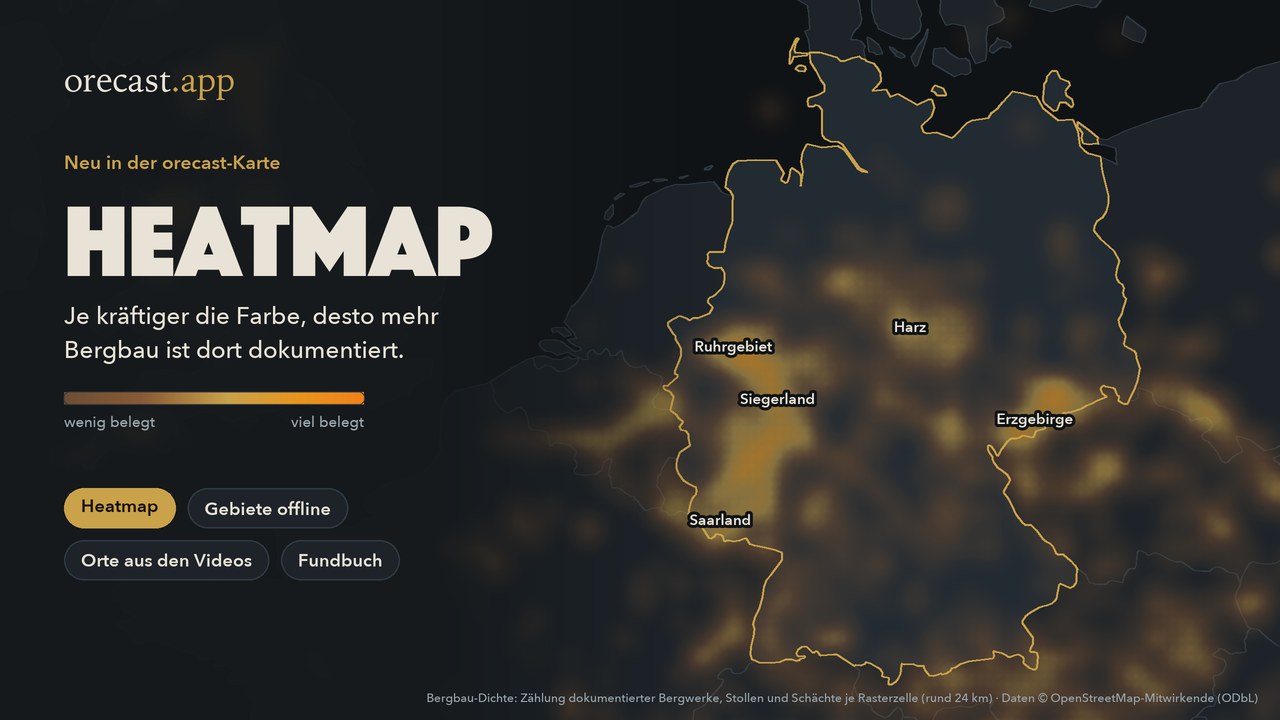
Single points on a map show what lies at one spot. How it all spreads across a whole country is hard to see from them. That is what the new heatmap is for. It colours the map strongly where a lot is documented and leaves it dark where little is known. The old mining districts stand out at a glance: the Ruhr, the Siegerland, the Harz, the Ore Mountains and the Saarland.
How to switch it on
In the web map, tap the layers button at the top right. At the bottom of the group "Mining and minerals" you find mining density, ore density and gold density, and in the group "Prehistory" the fossil density. One heatmap is shown at a time. If you are zoomed in close, the map zooms out when you switch it on, because the heatmap is an overview. Zoom in close and it fades out so you see the individual entries again. Without a subscription the heatmap in the web map stays coarse when you zoom in. The finer view and the gold density come with orecast Pro.
What it shows and what it does not
The heatmap counts documented entries per grid cell. A cell is never smaller than about three kilometres, so no individual site can be read from it. The colour tells you where a lot is recorded. It does not tell you where you will find something. Archaeological sites and traces of the war are deliberately left out. Many of them are protected monuments, and a map showing where they are densest would attract looters. Warnings about unexploded ordnance stay as individual markers on the map.
What the next app update brings
An update for the apps is ready and currently being tested. It brings the heatmap to your phone, along with several new features.
- Take an area with you. In the woods and in many valleys there is no signal. Save your area to your phone beforehand, and the map, the sites and the warnings about unexploded ordnance keep working offline. With a free account you can take one area with you, with orecast Pro several larger ones, and the relief scanner and aerial imagery come along too.
- Places from the videos. For every episode on our channel the app shows you the place on the map.
- My find book. Your finds with type, date and note, as a PDF if you like. You can then record a find without signal too. It uploads as soon as you have reception again.
- Place of the week. Once a week the app introduces a place when you open it.
- Low water. When the gauge on the Rhine, Elbe or Danube drops below the usual low water level, the app tells you. On the Elbe it also shows the documented hunger stones.
- Small things. You can share a place, for example in a message to friends, and the app starts where you left off.
As soon as the update is in the App Store and on Google Play, we will let you know here.
Also new on the website
For seven places from our episodes there are 3D models you can turn in your browser, from the underground of the Zollverein colliery to the Nördlinger Ries crater. They also appear as buttons right on the map. And if you prefer mail to videos, Werner's Fundbrief arrives once a month on the first Sunday, with a real place, two short news items and a tip for a day out. It is free, written in German, and you can unsubscribe with one click. The first issue goes out on 1 November.