 orecast
 Play video
Clicking loads the video from YouTube. Nothing is loaded from YouTube or Google before that.
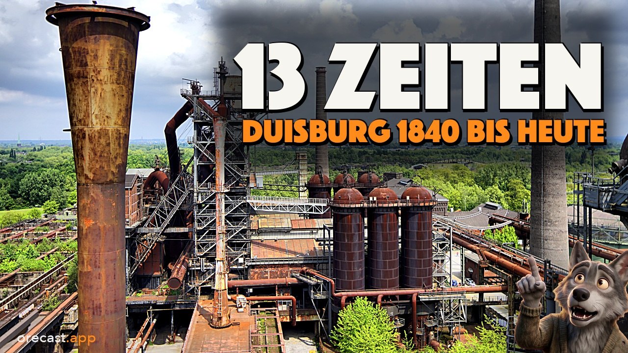
On 4 April 1985 the last shift ends in the north of Duisburg. Three hundred men leave an ironworks that has produced 37 million tonnes of pig iron in 82 years. They leave blast furnace 5 swept clean and ready to be fired up again. It could have been restarted, but nobody ever did. Today this place is called Landschaftspark Duisburg-Nord. In our new episode we stay on exactly this one spot between Meiderich and Hamborn and travel only through time. At orecast, thirteen maps and aerial photographs lie on top of each other there, precisely aligned.
First: what in the video is real and what is not
For every time layer we first show the real map sheet or the real aerial photograph. After that comes an AI reconstruction from the same viewpoint. These reconstructions only show what the map or aerial photograph of the time documents. What a farm looked like around 1840, or a hall in 1944, in detail is an assumption. The same applies to the images that look like old archive photos: the works gate in 1907, a tapping, the works in 1912, the ruins in 1944, blast furnace 5 in 1954, a change of shift and the last shift. These are not real photos. We recreated them with AI based on documented subjects and labelled them in the picture. The real photos are held by the Duisburg city archive and the thyssenkrupp Corporate Archives. The maps, the aerial photographs and today's photos from the park, on the other hand, are real and unaltered.
Around 1840: farmland on the Emscher
The first time layer is the first Prussian survey, the Uraufnahme, drawn between 1836 and 1850. Where the blast furnaces stand today, the Emscher winds in loops through wet meadows. A few farms stand on the dry spots, with paths running between them. At the time the area was called the farming community of Lösort. The map shows nothing more. Our reconstruction of a farm on a bend of the Emscher is therefore explicitly an imagined scene. The only certain things are what the sheet records: the course of the river, the farms and the paths.
Around 1900: railways, collieries and an ironworks
The second Prussian survey, the Neuaufnahme, dates from 1891 to 1912. The Emscher is still there, but railway lines now cut through the meadows. Nearby lies Neumühl station on the Cologne-Minden railway, and right next door the collieries of the Gewerkschaft Deutscher Kaiser are mining coal. The coalfields belong to August Thyssen. In July 1901 he begins building an ironworks right beside them. On 16 May 1903 blast furnace 1 is blown in, which is the term for lighting a blast furnace for the first time. Blast furnace 2 follows in August 1903, and by 1912 all five blast furnaces are running on the old floodplain.
1926 to 1938: the works from above
With the 1926 aerial photograph of the Ruhr Regional Association you no longer see a drawing for the first time, you see the works itself, with furnaces, tracks and spoil heaps. At that time the Meiderich works produced pig iron in many grades side by side, including haematite, foundry and steelmaking pig iron. That is why it was called the pharmacy of the Ruhr. Next come the aerial photograph of 1934, the Duisburg city map from 1936 to 1938 and the 1:25,000 topographic map from 1936 to 1945. On the city map the works is a grey block with tracks, on the photograph it is a busy plant. On both, the Emscher has become a straight line. According to the city, its historical city maps are not positionally accurate, and we note this on the map as well.
23 March 1945: the US aerial photograph
The seventh time layer is a serious one. On 23 March 1945 an American reconnaissance aircraft photographs the Ruhr, and a second image is taken two days later. The pictures are held today by the US National Archives. We have fitted them onto our map. Along the western edge of our section runs a narrow strip for which no image exists. East of it the works can be seen in full. In 1944 three heavy air raids had hit the works and production came to a standstill. We show what the photograph shows, and nothing more. We do not know what the halls looked like inside at the time. Our reconstruction of this period therefore stays empty, without people. After the war the works was not on the dismantling list. It was allowed to be rebuilt, initially with two blast furnaces.
An important note on this image: unexploded bombs may still lie in the ground. Do not dig and do not touch anything. If you find something suspicious, report it to the police on 110, the German emergency number.
1952 to 1969: reconstruction
The aerial photographs of the Ruhr Regional Association from 1952, 1963 and from around 1969 show the works growing back. In 1952 a new blast furnace 5 is built to replace the old blast furnace 4. On the image from around 1969 the works has become very large, with new halls and bunkers for the ore. In 1973 blast furnace 5 receives the steel frame that still surrounds it today.
Beneath the park: gravel and coal with first names
Halfway through the episode we cut the spot open vertically. The relief from the digital terrain model shows almost no height differences. It is a flat floodplain on the old course of the Emscher. The geological overview map of the Federal Institute for Geosciences and Natural Resources records sand and gravel here, with layers of clay and silt. Beneath it, the soil map of the Geological Survey of North Rhine-Westphalia shows a layer of gravel and gravelly sand. According to this map it is between 4 and 7.5 metres thick. We do not know it more precisely, and so we only give this range. The blast furnaces still stand on this gravel today.
Below lies the Carboniferous, layers that are more than 300 million years old. The coal layers within them are called seams. In the 1:10,000 coal map of the Geological Survey of North Rhine-Westphalia they have names around this spot: the Mathias 1 seam, the Anna seam, the Zollverein 8 seam and the Katharina seam. This map does not say how deep they lie. It only marks where a seam meets the top of the Carboniferous. But it explains the place. Thyssen built his works next to his coal, on a low-lying plain that the railway already crossed.
1985: the end of the ironworks
On the city map of 1980 and 1981 the works still appears in full. But from 1979 the sales crisis deepens, and in the early 1980s blast furnaces 1 and 2 are shut down. In 1982 blast furnace 5 is relined once more, which means its inside is bricked anew. Then come the steel quotas of the European Community, and it is the end for the Meiderich works. On 4 April 1985 the last shift ends. Three hundred employees are still there. They are offered replacement jobs in Ruhrort and Hamborn. The park's operator writes today that the end came as a complete surprise to the workforce. We did not find the name of a worker from that last shift, so we do not invent one either.
Today: the Landschaftspark
At the end of the 1980s the state of North Rhine-Westphalia buys the site and makes it a project of the International Building Exhibition Emscher Park. In 1989 an international competition is announced, and in 1991 the landscape architect Peter Latz wins it. In 1994 the first part of the park opens. Since 2000 the works has been a listed monument. The aerial photograph from the 1990s shows the conversion, today's aerial photograph shows the result. Of the five blast furnaces, three are still standing. Blast furnace 5 is 54 metres high and the only one that visitors can walk around freely. People climb in the old ore bunkers and dive in the gasometer, and from Friday to Sunday the furnaces light up in red, green and blue after dark. The park is at Emscherstraße 71, 47137 Duisburg. It is open all year round, day and night, and admission is free. Whether blast furnace 5 is open in the evening is stated on the park's website, so it is worth checking there before a visit. You no longer see the Emscher in the park. It was straightened and moved, and today the Alte Emscher flows there.
All thirteen time layers in orecast
The thirteen layers of this episode are the first Prussian survey, the second Prussian survey, the aerial photographs of 1926 and 1934, the city map of 1936 to 1938, the 1:25,000 topographic map, the US aerial photograph of March 1945, the aerial photographs of 1952, 1963 and around 1969, the city map of 1980/81, the aerial photograph from the 1990s and today's aerial photograph. In the orecast map the layer for this is called „Früher“ (Then). With a time slider you lay the old maps and aerial photographs over today's map, at this spot and wherever we have such sheets. The layer is part of Pro. At the same point the map also shows the gravel and the coal seams. The short link orecast.app/t/duisburg opens the map right here. The app is available for iPhone and for Android.
Now it is your turn: which spot should we take through time next? Tell us your place below the video.
Sources and image credits
Landschaftspark Duisburg-Nord (chronicle, operating years, closure, blast furnace 5). LVR, Kulturlandschaft Rheinland (KuLaDig), Hüttenwerk Meiderich, KLD-262014. Prussian Uraufnahme and Neuaufnahme, TK25, DGM1 and aerial photographs: Geobasis NRW, dl-de/zero-2-0. Aerial photographs 1926, 1934, 1952, 1963 and 1969: Regionalverband Ruhr, dl-de/by-2-0, data modified (tiling). City maps 1936 to 1938 and 1980/81: © Stadt Duisburg, Historische Stadtpläne, CC BY 3.0 DE, not positionally accurate. US aerial reconnaissance 23 and 25 March 1945: National Archives and Records Administration, RG 373, public domain, georeferenced by orecast. Ground: Geologischer Dienst NRW, RK50 and coal map 1:10,000; BGR GÜK250. Base map: © GeoBasis-DE / BKG (2026) CC BY 4.0 (basemap.de).
Photos of today (Wikimedia Commons): 500px photo (28866055).jpeg, Marcel Spunkt, CC BY 3.0 · AW Landschaftspark Duisburg Nord Klaerbecken.jpg and AW Landschaftspark Duisburg Nord vor Hochofen 5.jpg, Alice Wiegand, CC BY-SA 4.0 · Abandoned steel production plant, Landshaftspark Duisburg-Nord HDR (47870917091).jpg, Edwin van Buuringen from The Hague, Netherlands, CC BY 2.0 · Alte Kokerei in Duisburg (25797337178).jpg, dronepicr, CC BY 2.0 · Duisburg Landschaftspark Duisburg-Nord 06.jpg and 07.jpg, Zairon, CC BY-SA 4.0 · Duisburg Landschaftspark Nord 12.jpg, Stahlkocher, CC BY-SA 3.0 · Duisburg Landschaftspark blast furnace 1 & 2.jpg, blast furnace 2 & 1.jpg and blast furnace 2 at night.jpg, Arnoldius, CC BY-SA 4.0 · Duisburg (DE), Landschaftspark Nord, Hochofen 5, 2022, 0083.jpg, Anil Öztas, CC BY-SA 4.0 · Duisburg (DerHexer) 2010-08-11 037.jpg, 044.jpg and 045.jpg, DerHexer, CC BY-SA 3.0 · Duisburg, Landschaftspark Duisburg-Nord, Hochofen 5, 2024, 4243-7.jpg, 4263-7.jpg and Ausblick 4232.jpg, Dietmar Rabich, CC BY-SA 4.0 · Hochofen 5 Landschaftspark Duisburg Nord Abend 2013.jpg, Tuxyso, CC BY-SA 3.0.
AI notice: the AI reconstructions and the recreated archive photos were generated and animated with AI and are labelled in the picture. The voice is an AI voice, Werner the wolf is an AI character, and the music was generated with AI. Real maps, aerial photographs and photos are not altered.
Illustrations generated with AI.
Frequently asked questions
Are the old photos in the video real?
No. The images that look like archive photos, such as the works gate in 1907, the tapping, the works in 1912, the ruins in 1944, blast furnace 5 in 1954, the change of shift and the last shift, are AI reconstructions based on documented subjects. They are labelled in the picture. The maps, the aerial photographs and today's photos are real and unaltered. Real historical photos of the works are held by the Duisburg city archive and the thyssenkrupp Corporate Archives.
When was the Meiderich ironworks closed?
The last shift ended on 4 April 1985. Three hundred employees were still there, and they were offered replacement jobs in Ruhrort and Hamborn. Blast furnace 5 was left swept clean and ready to be fired up again. In 82 years the works had produced 37 million tonnes of pig iron.
What coal lies beneath the Landschaftspark?
Beneath the Emscher gravel lies the Carboniferous. The 1:10,000 coal map of the Geological Survey of North Rhine-Westphalia records, among others, the seams Mathias 1, Anna, Zollverein 8 and Katharina in the surrounding area. The map shows where a seam meets the top of the Carboniferous. It does not say how deep the seams lie.
How can I see the thirteen time layers myself?
In the orecast map the layer is called „Früher“ (Then). With a time slider you lay the old maps and aerial photographs over today's map. The layer is part of Pro. The short link https://orecast.app/t/duisburg opens the map directly at this spot.
May I search the grounds for traces of the war?
No. Unexploded bombs may still lie in the ground. Do not dig and do not touch anything. If you find something suspicious, report it to the police on 110, the German emergency number.