 orecast
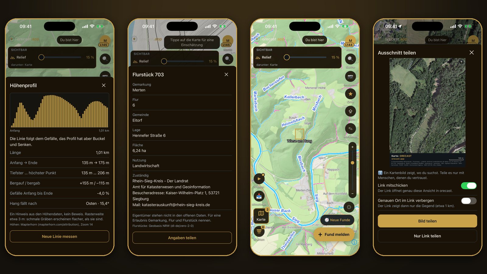
orecast 1.0.16 is out for iPhone and Android. The update brings tools to your phone that were only on the web map until now: an elevation profile, the boundaries of land parcels, streams and rivers with their names, your own markings and a button for sharing your map view. Almost all of it is free.
Elevation profile: stream or ditch?
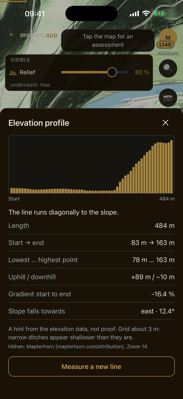
In the woods you often see a channel or a bank and wonder what it is. The elevation profile helps with a first assessment. In the map selection, under relief, you find the button "Measure elevation profile". Every tap on the map sets a point, up to twenty. The app then shows how the ground rises and falls along the line: length, lowest and highest point, uphill and downhill, the gradient and which way the slope faces.
It also adds a sentence about the line's position on the slope. If the line steadily follows the gradient, there is usually a stream, a channel or a sunken lane. If it runs across the slope, water does not flow there by itself, so ditches, banks or tracks are more likely. This is a hint from the elevation data, not proof. The data has a grid of about three metres, so narrow ditches look shallower than they are. Without a subscription the app measures within one kilometre of the first point, with orecast Pro everywhere.
Land parcels: whom do I ask?
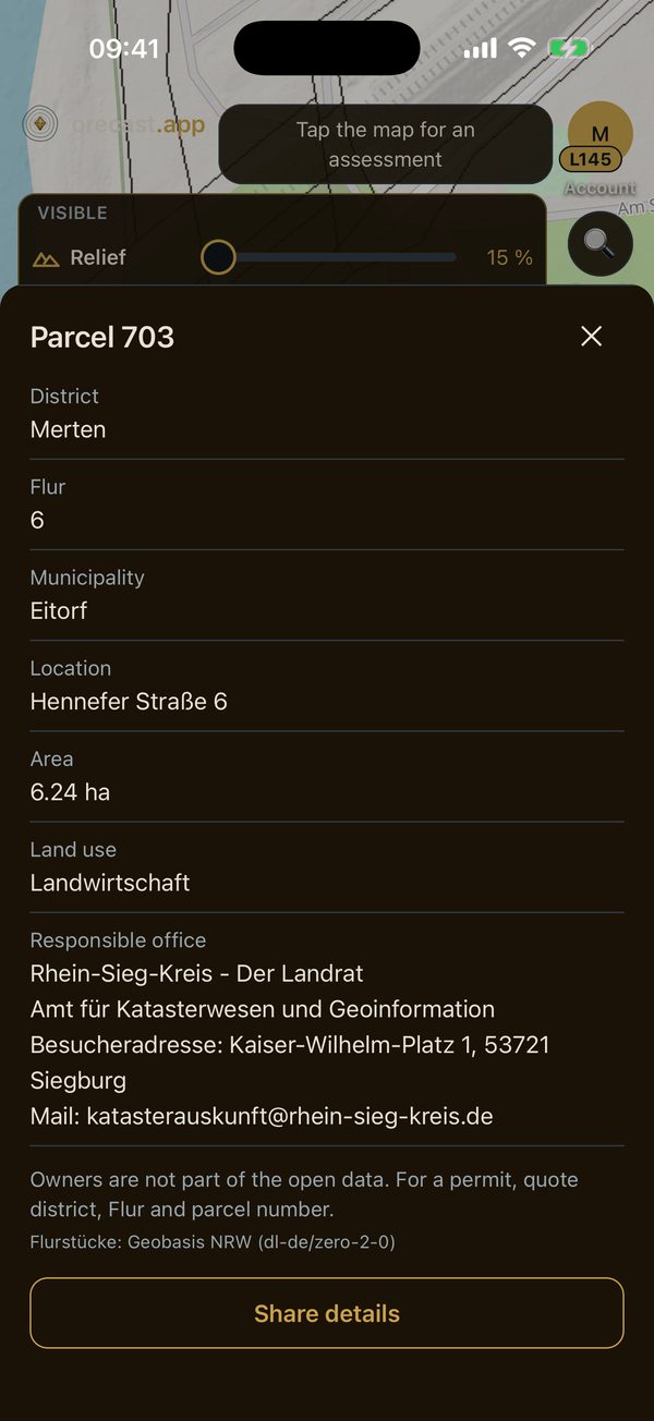
If you want to search a field, you need permission from the owner or tenant. It helps to be able to name the plot exactly. The new land parcels layer shows boundaries and numbers once you zoom in close. Tap a parcel to open its details: cadastral district, field section, parcel number, municipality, location, area, land use and the responsible office. With "Share details" you can send all of this to the municipality or the farmer, for example.
Owners are not part of the open data, so the app does not show them. Full details are available in North Rhine-Westphalia, Berlin, Brandenburg, Thuringia, Rhineland-Palatinate, Saxony and Mecklenburg-Western Pomerania, boundaries only in Bavaria and Baden-Württemberg. The layer is free.
Waters: streams with names
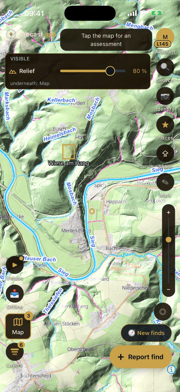
Many small streams are missing from ordinary maps or have no name there. The waters layer draws streams and rivers in blue over any map, including relief and aerial photos, and adds their names. In North Rhine-Westphalia it is especially precise and even shows underground sections in purple, such as adits or pipes. In the rest of Europe the network is coarser and, when zoomed in close, only roughly follows the actual course. The layer is free and needs a network connection.
Mark your own points and areas
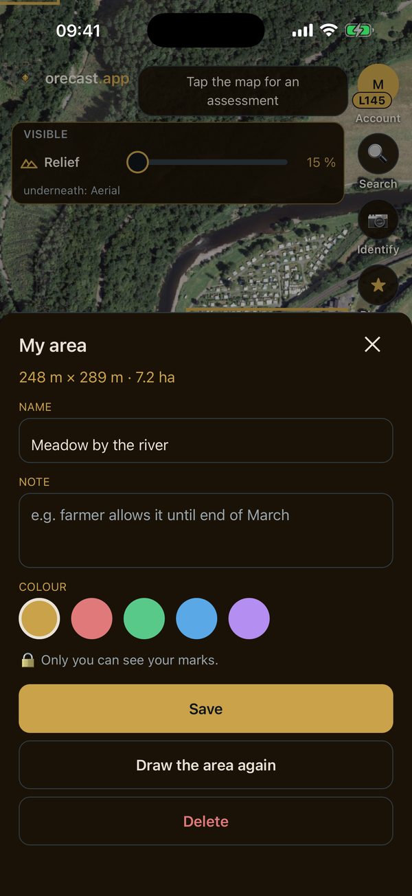
With the pen button on the right you set a point or drag a rectangle with one finger. Each marking gets a name, a note and a colour, for example "Farmer's permission until the end of March". The app works out the size of the area straight away. Only you can see your markings. With an account they are backed up as well.
Share the map
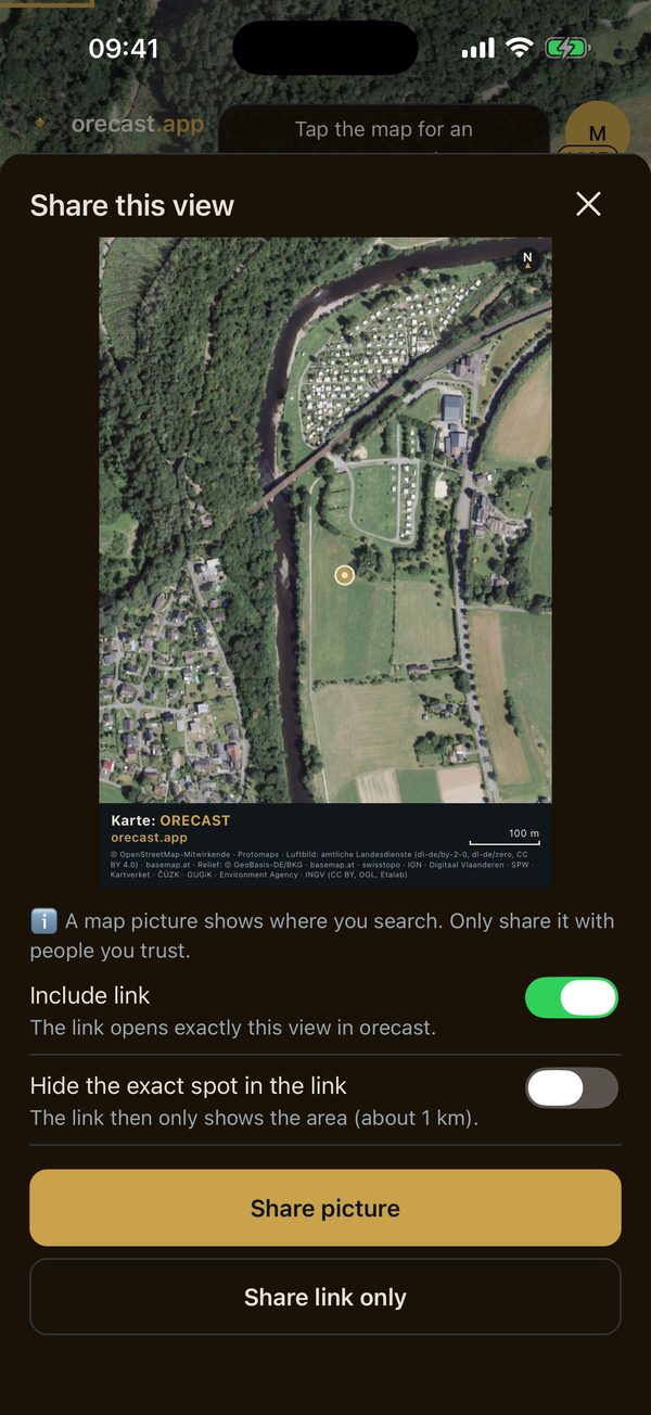
The "Share" button makes a picture of the current map view, with all layers just as you see them. If you like, a link comes along that opens exactly this view in orecast. If you do not want to give away the exact spot, switch on "Hide the exact spot in the link". The link then only shows the area to within about one kilometre. The app reminds you: a map picture shows where you search, so only share it with people you trust.
Also new
- Aerial photos from the 2000s. The aerial photo timeline has a new step for the 2000s, in North Rhine-Westphalia, Baden-Württemberg, Rhineland-Palatinate, Saxony and Bremen. You can see what has changed over the last twenty years. This step is part of orecast Pro.
- Around you. On first launch a card shows what lies near you and takes you to the nearest entry with one tap.
- Relief free again. The relief scanner and hollows & channels are available again without a subscription as a preview within one kilometre. The relief now also stays visible after a longer break.
On the web map too
Elevation profile, land parcels, waters, marking and sharing are also available on the web map. If orecast is already on your phone, the update arrives by itself or through your store. New here? Get orecast on the App Store and on Google Play.
Please play fair
Knowing a parcel is not the same as having permission. You may only search and dig with the owner's consent, and never on protected monuments without a permit from the heritage authority. If you find ammunition, leave it where it is and call the police, in Germany on 110.