 orecast
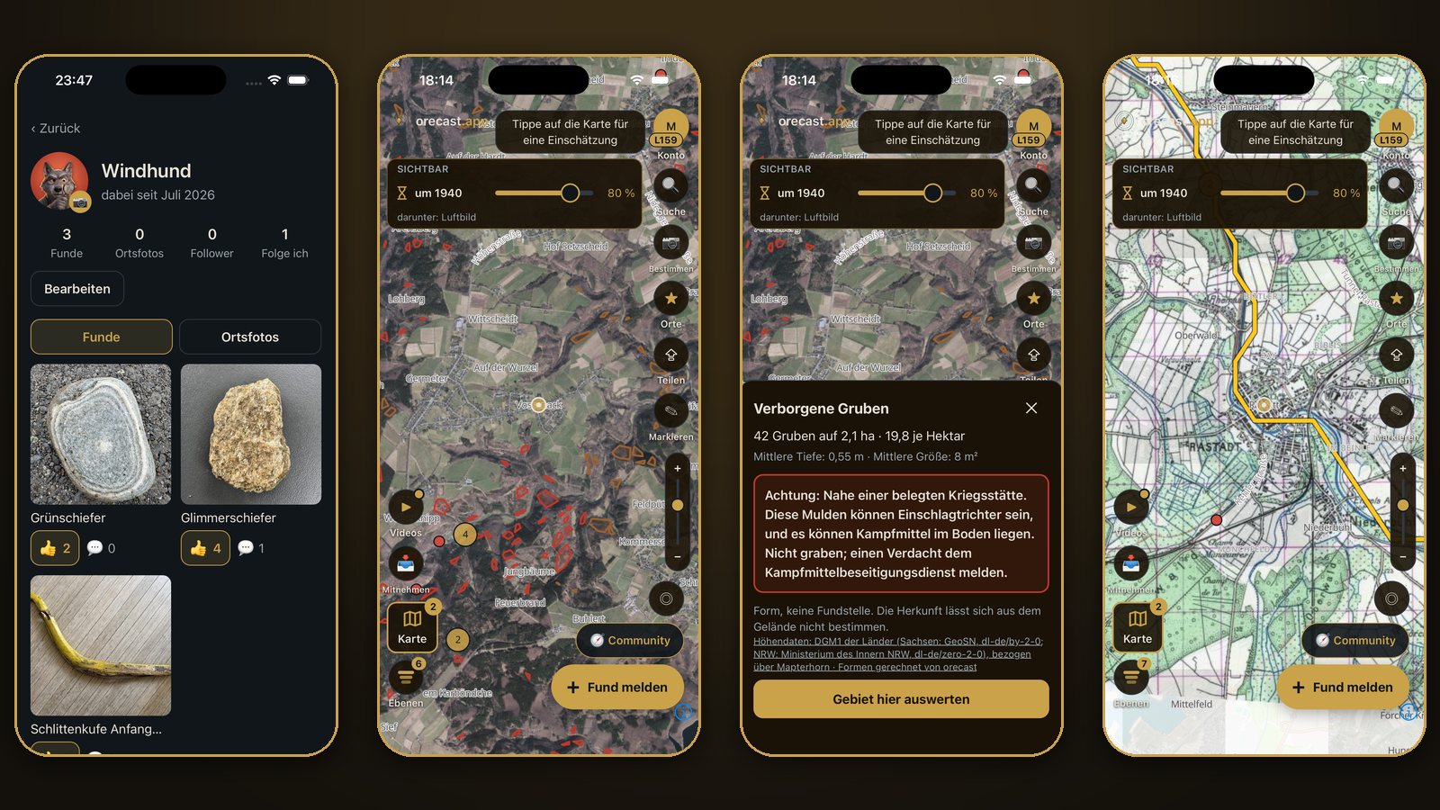
orecast 1.0.18 is out for iPhone and Android. The update brings three things to your phone that were only on the web map until now, or have only just arrived there: a community with its own profiles, the hidden pits layer and the gold trail in rivers. Place names now also stay readable over aerial imagery, relief and old maps, and on Android the map starts more reliably.
Community: your profile, following and place photos
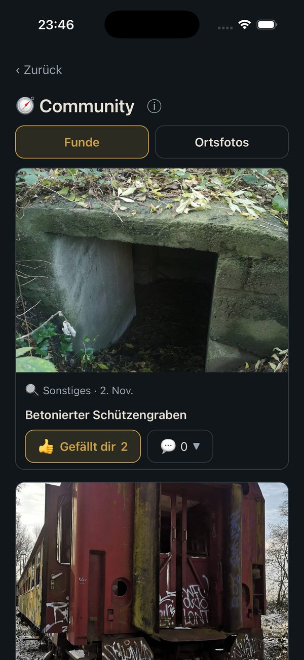
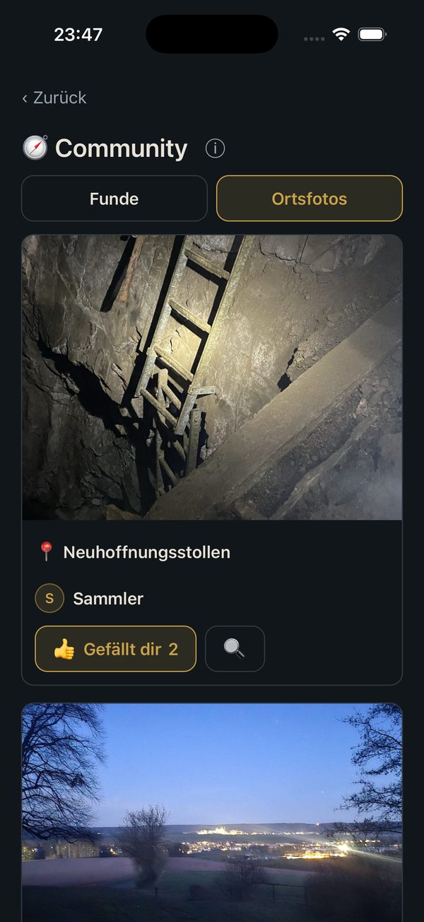
"New finds" becomes the community. The button at the bottom right of the map takes you there. It has two tabs: "Finds" shows the approved finds of other collectors with photo, type and date, "Place photos" shows the latest pictures of adits, spoil heaps, bunkers and viewpoints. Tap a place photo to jump to that spot on the map.
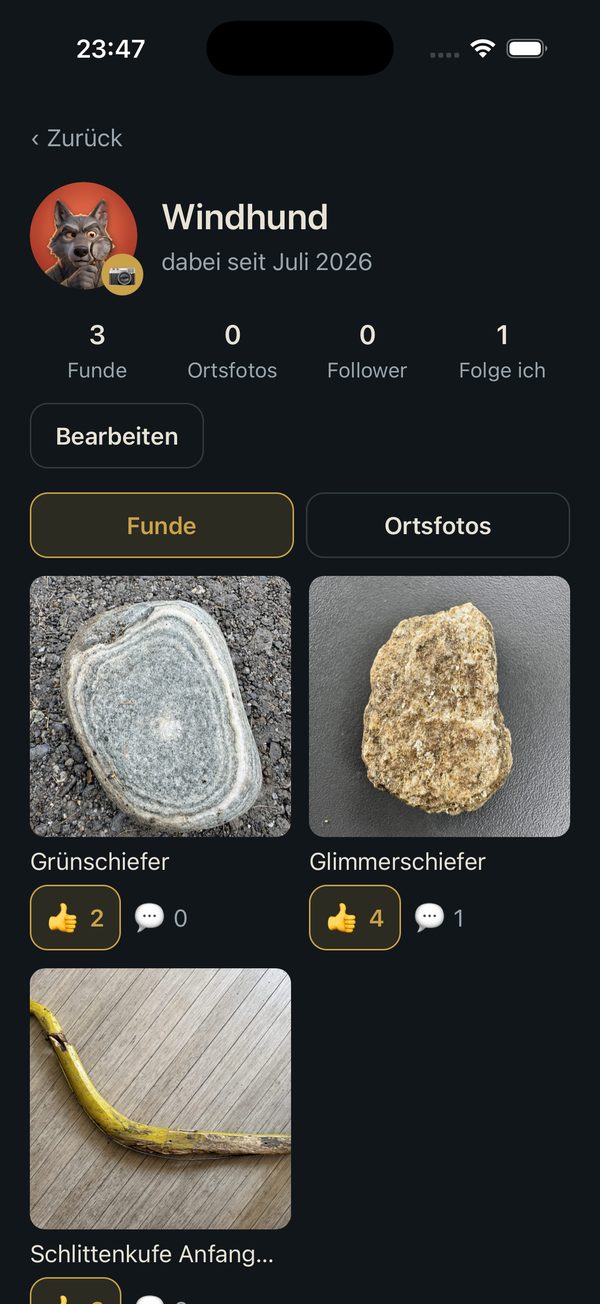
Anyone who has published a find or a place photo gets their own profile with their approved posts. You reach it through the name in the feed or in a find's comments, and your own through "My profile" in your account. You can follow other collectors, set a profile picture and change your display name. Profile pictures are checked before they appear.
A few things stay as they were. Your display name is a pseudonym, nobody sees your e-mail address. Who follows whom is visible only to you in your own lists. Exact find locations remain coarsened to about five kilometres. And as before, you can report posts and profiles or block a user. The community is free; to take part you need an account.
Hidden pits: we counted the holes in the woods
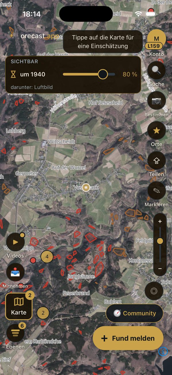
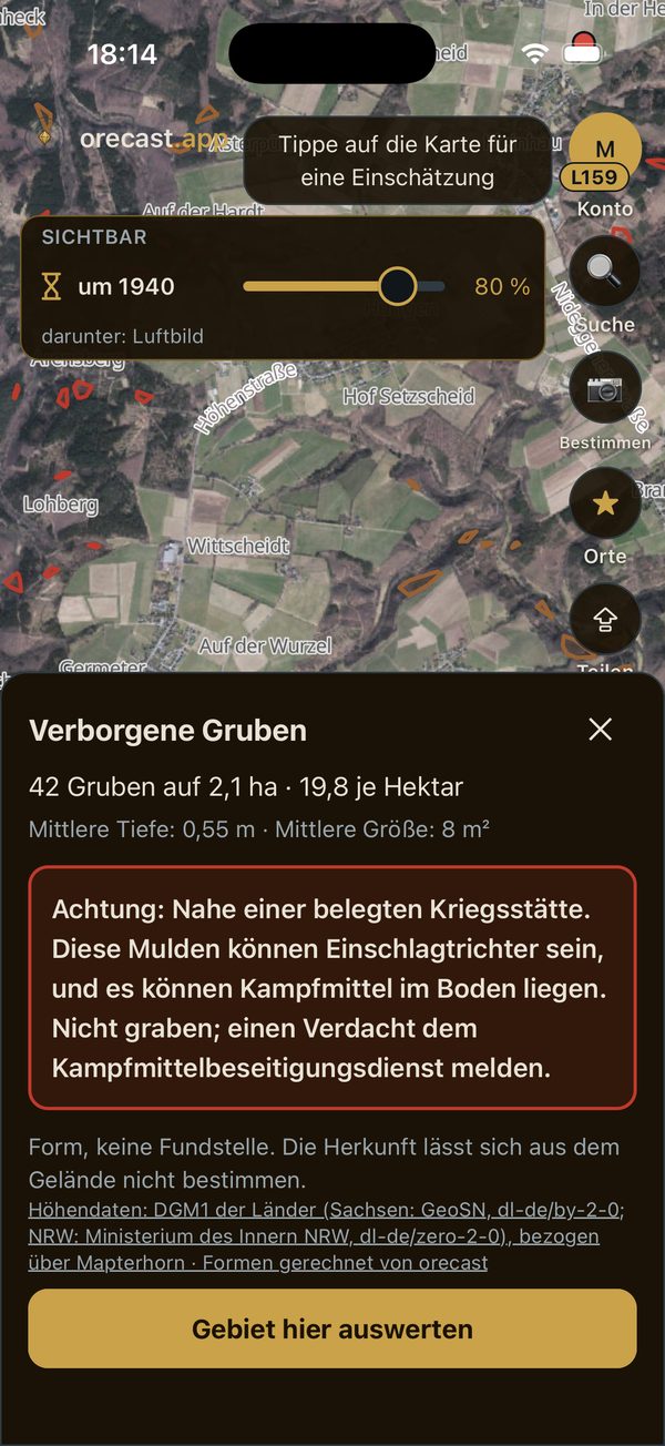
They stand out in the lidar relief: fields full of small round hollows, often deep in the forest. The new layer shows the places where the computer found many of them close together: at least eight pits, no more than 40 metres apart, at least two per hectare. The fields lie as brown areas beneath the find markers and above relief, aerial imagery and old maps. Tap a field to see the number of pits, the area in hectares, the density, the median depth and the median size, plus the number of large pits. "Assess this area" opens the profile for the surroundings.
So far the northern Eifel and the Ore Mountains around Freiberg have been computed, a good 1,300 fields in total. More regions will follow. At the well-known Treppenhauer pit field near Sachsenburg the computer finds 219 pits on 16 hectares, without any prior knowledge. The layer appears at a close zoom, needs a network connection and is part of orecast Pro, with or without an account.
Important: a pit field is a shape, not a find spot. Where the hollows come from, whether old mining, charcoal burning, quarrying, war or nature, cannot be told from the terrain. Fields near a documented war site are drawn in red with a warning: these hollows may be impact craters, and there may be unexploded ordnance in the ground. Do not dig there; report a suspicion to the explosive ordnance disposal service.
The gold trail in rivers
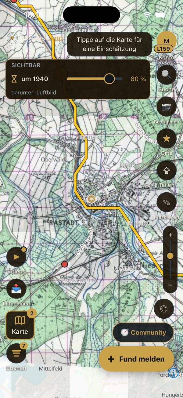
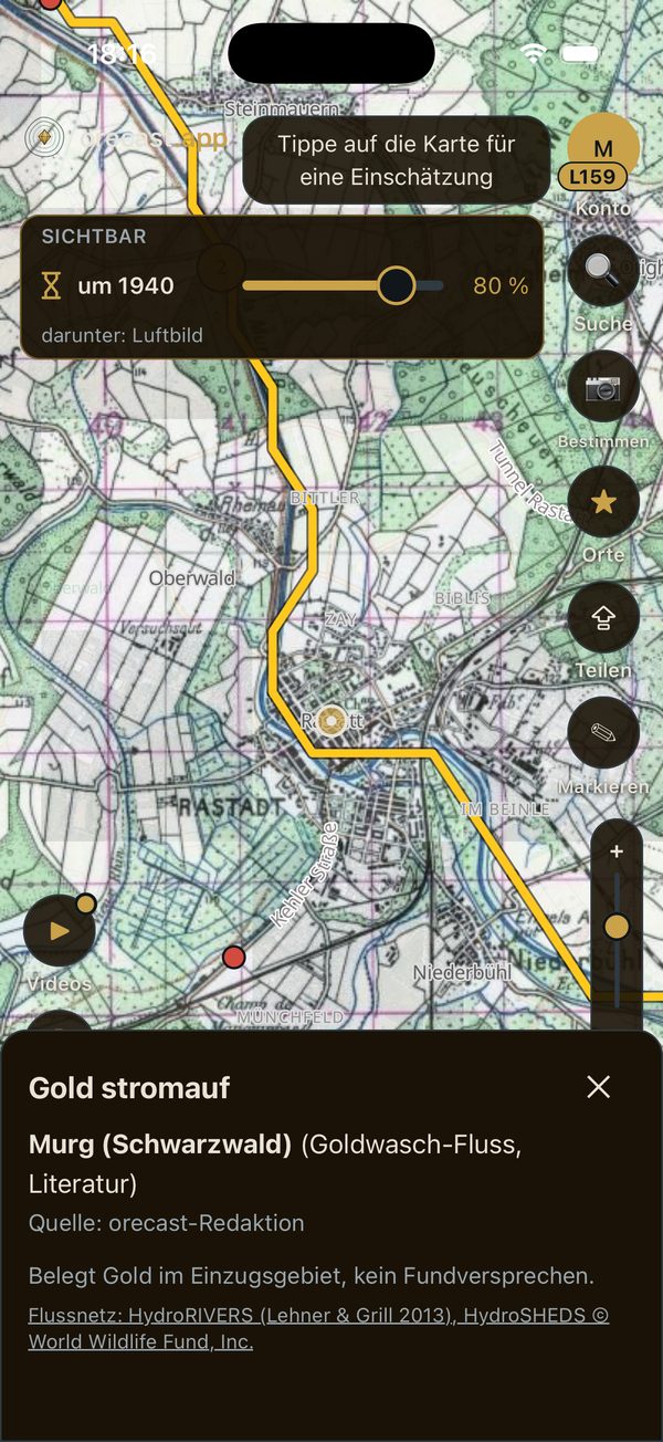
The gold trail shows river stretches up to 300 kilometres below a documented gold occurrence, as a golden line over any map, even in the overview. The lighter the line, the closer the occurrence upstream. Tap the line to see the nearest documented occurrence upstream with its type, the distance in kilometres and the source: a gold occurrence from a geological survey, a geotope for gold panning, a mine, or a river whose gold is documented in the literature. Examples are the Oker below the Rammelsberg near Goslar, the Eder below the Eisenberg near Korbach, or the Murg in the Black Forest.
Gold upstream does not mean you will find gold at this spot. The line only says that gold is documented in the catchment. The river network comes from HydroRIVERS, part of the HydroSHEDS database of the World Wildlife Fund. Its licence requires a personal confirmation, which is why the gold trail needs an orecast account and orecast Pro. The first time you switch it on, you confirm the terms in section 6a of the terms of use once. For the same reason the gold trail is not included in offline areas and does not appear in shared map pictures.
Also new
- Place names stay readable. Until now, towns, villages and river names disappeared as soon as aerial imagery, relief or an old map lay over the map. Now they sit on top, and the find markers still sit above the lettering.
- Android: more stable map at start. A crash that in rare cases occurred right when the map started has been fixed. The profile that only showed "Try again" when no distance was available has been repaired as well.
On the web map too
Community, hidden pits and the gold trail are also on the web map: the two layers in the map picker, the community through the button of the same name. If orecast is already on your phone, the update arrives by itself or through your store. New here? Get orecast on the App Store and on Google Play.
Please play fair
A pit field on the map is not a licence. Old adits and shafts are deadly, never enter them. You may only search and dig with the owner's consent, and never on protected monuments without a permit from the heritage authority. If you find ammunition, leave it where it is and call the police, in Germany on 110.